
Features
Rasters.io, innovation at the heart of your operations
General Features
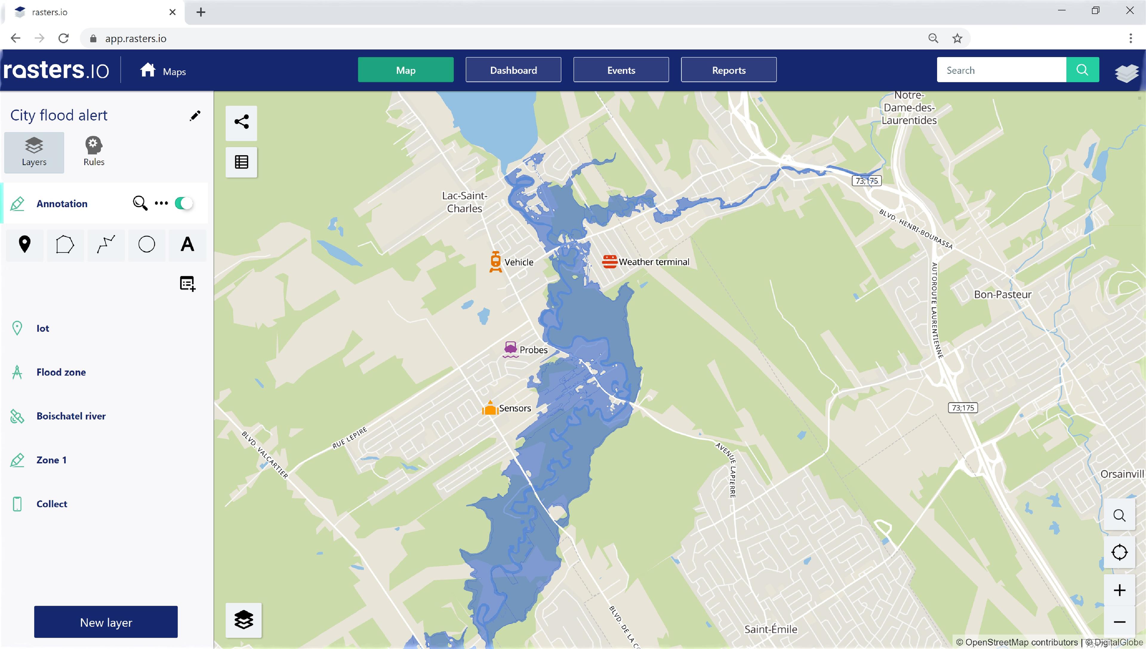
Connected objects
Connect different types of equipment to the same platform
- Vehicles (GPS and engine data)
- Sensors (hydraulic, weather, etc.)
- Probes (Temperature)
- Spreader controllers
Know your operations with the real-time display of the sensors data on the map as well as the detailed equipment data to obtain their status and history.
Get notified immediately if something goes wrong and save precious minutes to take action.
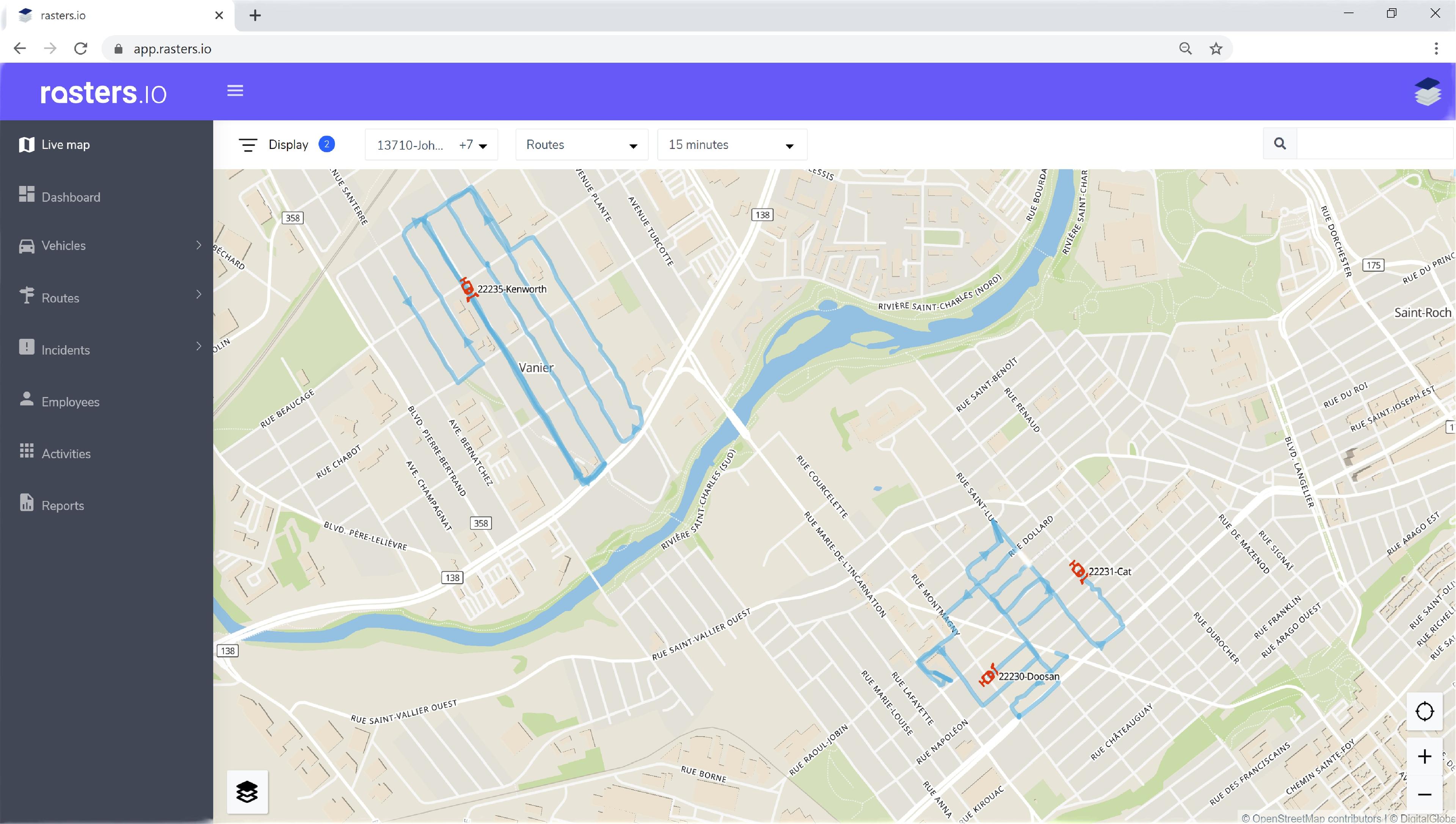
Live map
Locate all your equipment on the map in real time in order to have a quick overview to understand the situation and analyze it.
Track the progress of your operations over a period of time, filter by activities, view your incidents, view your areas of interest, view your routes and search for anything on the map.
The live Map is a simple and powerful tool providing the detailed information you need.
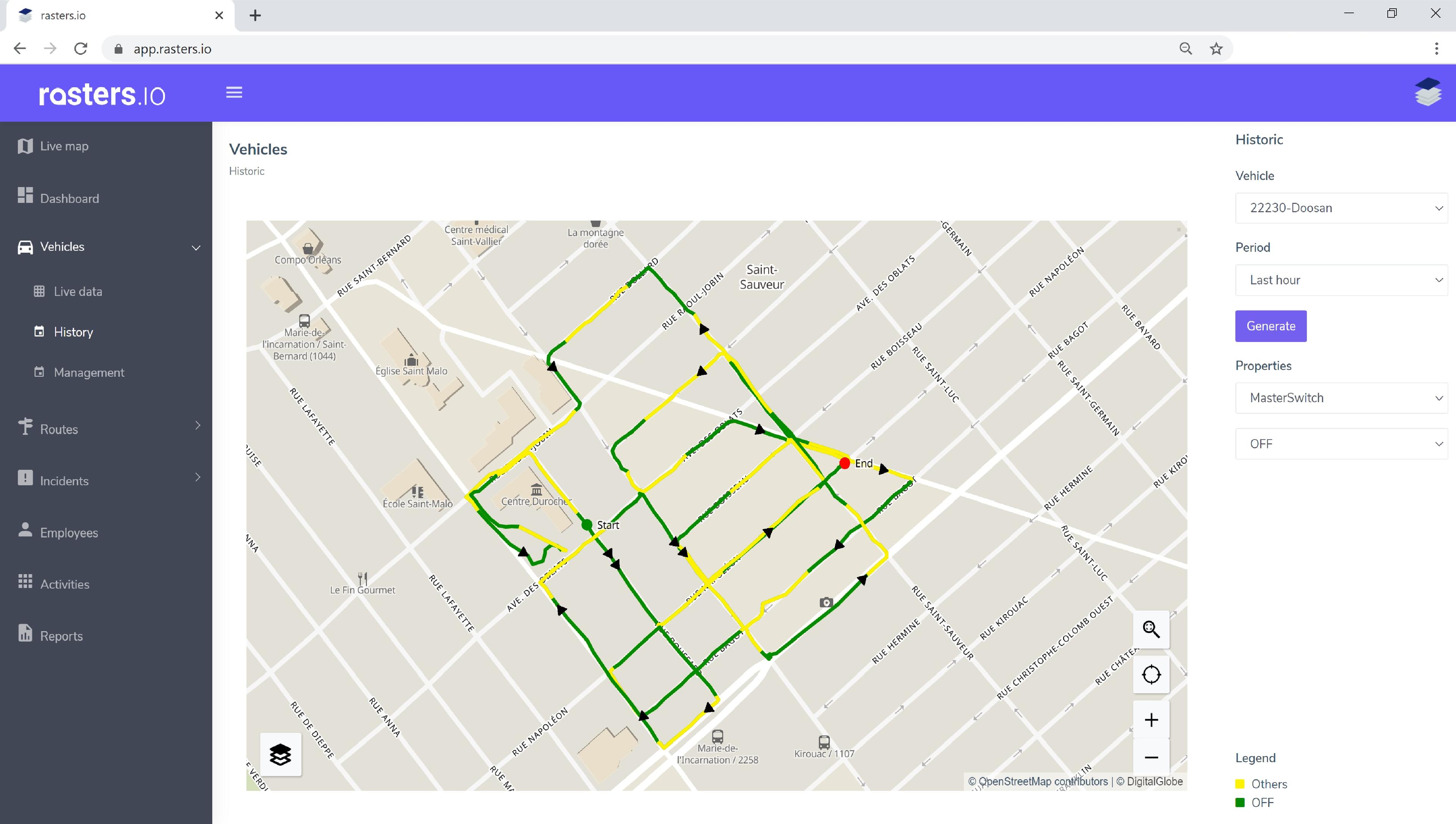
Vehicle history
View and replay a specific history for one or more vehicles in the "Vehicle History" section.
Choose a vehicle and a period of time to display the historical trace on the map and view all the telemetry information available by clicking on a point on the trace.
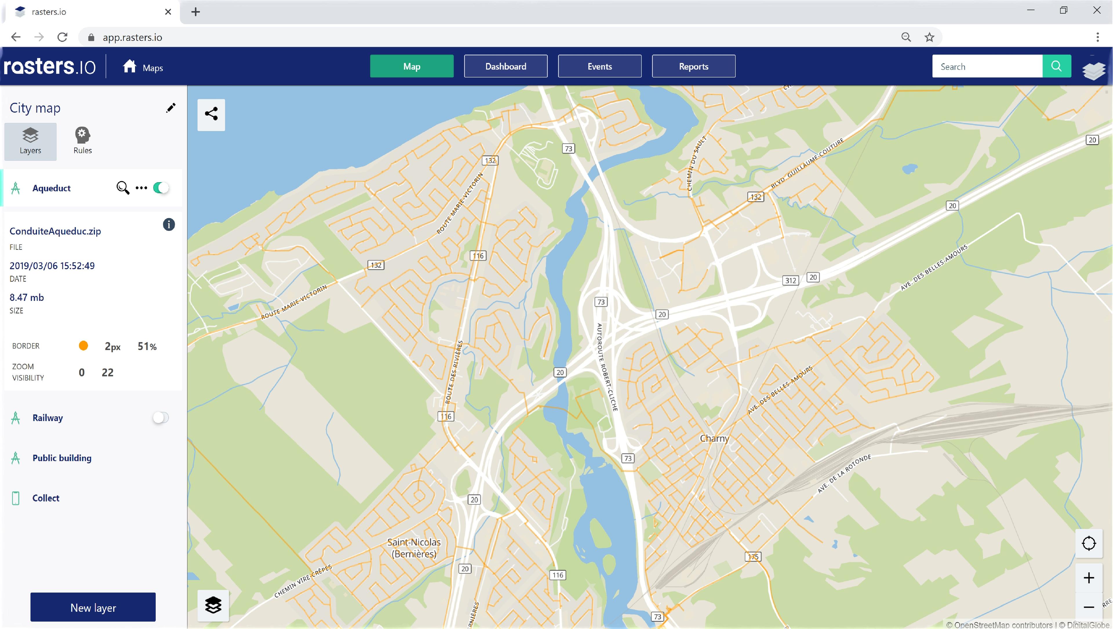
Adding geographic layers
Add geographic data layers to a map in an organization with this module.
- Roads, sidewalks
- Cadastre
- Infrastructure network (aqueduct, railways, etc.)
- Standpipes, manholes, etc.
- Drone images, orthophotos (satellite and aerial images).
Add your own layers of always up-to-date and more precise data which makes it easier to geolocate your "assets" and link them, for example, to inspection tasks, work and/or operator visits.
Connect different types of equipment to the same platform
- Vehicles (GPS and engine data)
- Sensors (hydraulic, weather, etc.)
- Probes (Temperature)
- Spreader controllers
Know your operations with the real-time display of the sensors data on the map as well as the detailed equipment data to obtain their status and history.
Get notified immediately if something goes wrong and save precious minutes to take action.
Locate all your equipment on the map in real time in order to have a quick overview to understand the situation and analyze it.
Track the progress of your operations over a period of time, filter by activities, view your incidents, view your areas of interest, view your routes and search for anything on the map.
The live Map is a simple and powerful tool providing the detailed information you need.
View and replay a specific history for one or more vehicles in the "Vehicle History" section.
Choose a vehicle and a period of time to display the historical trace on the map and view all the telemetry information available by clicking on a point on the trace.
Add geographic data layers to a map in an organization with this module.
- Roads, sidewalks
- Cadastre
- Infrastructure network (aqueduct, railways, etc.)
- Standpipes, manholes, etc.
- Drone images, orthophotos (satellite and aerial images).
Add your own layers of always up-to-date and more precise data which makes it easier to geolocate your "assets" and link them, for example, to inspection tasks, work and/or operator visits.
Reporting Features
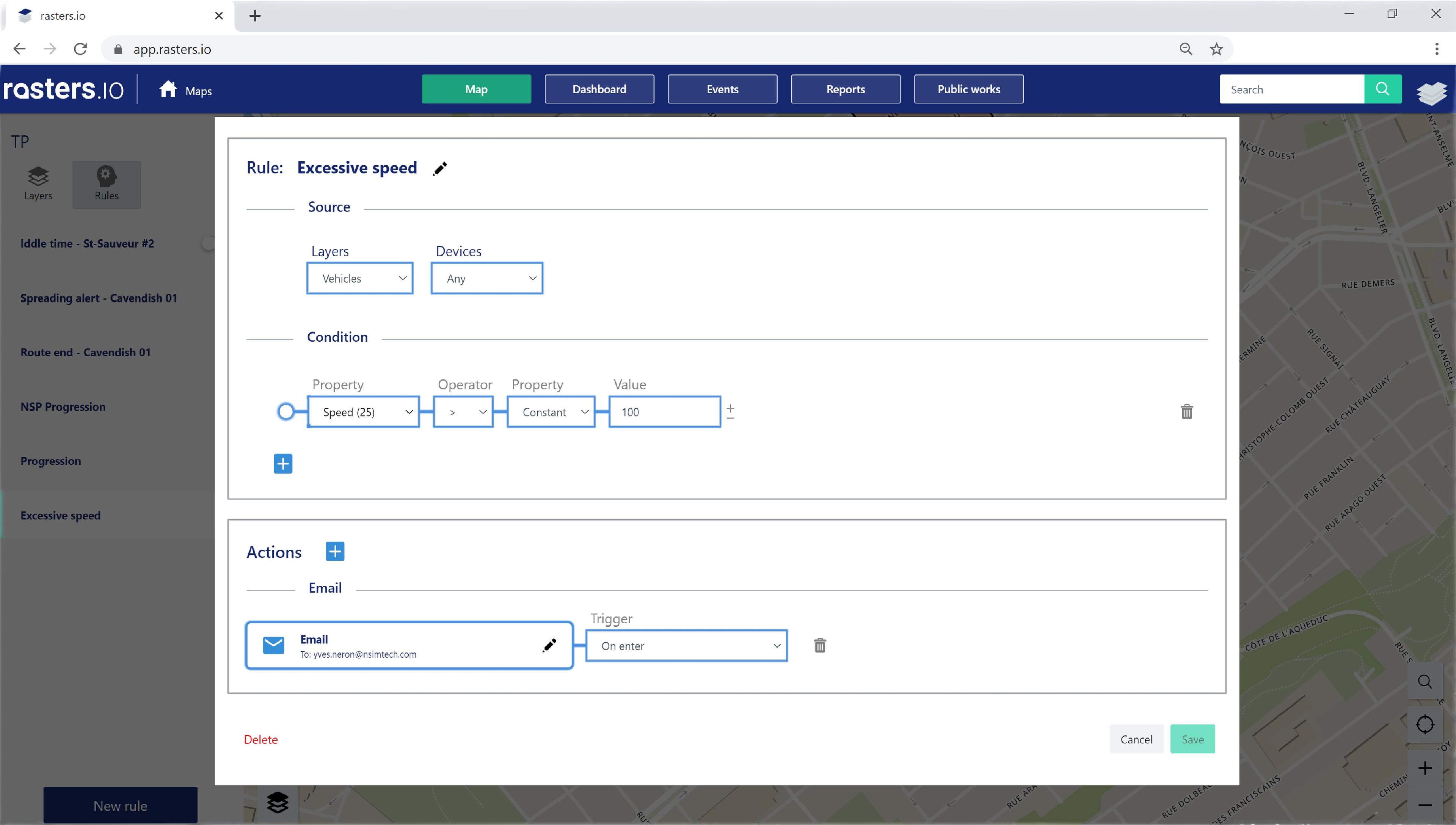
Alerts and notifications
Collect various information about your vehicles, equipment and sensors with Rasters.io.
The alerts and notifications module allows you to analyze all this information in real time in order to warn you of problematic situations.
Whether it is to monitor the status of equipment, the fuel consumption of vehicles or the idle time in a specific area, Rasters.io will keep you informed and always in control 24/7.
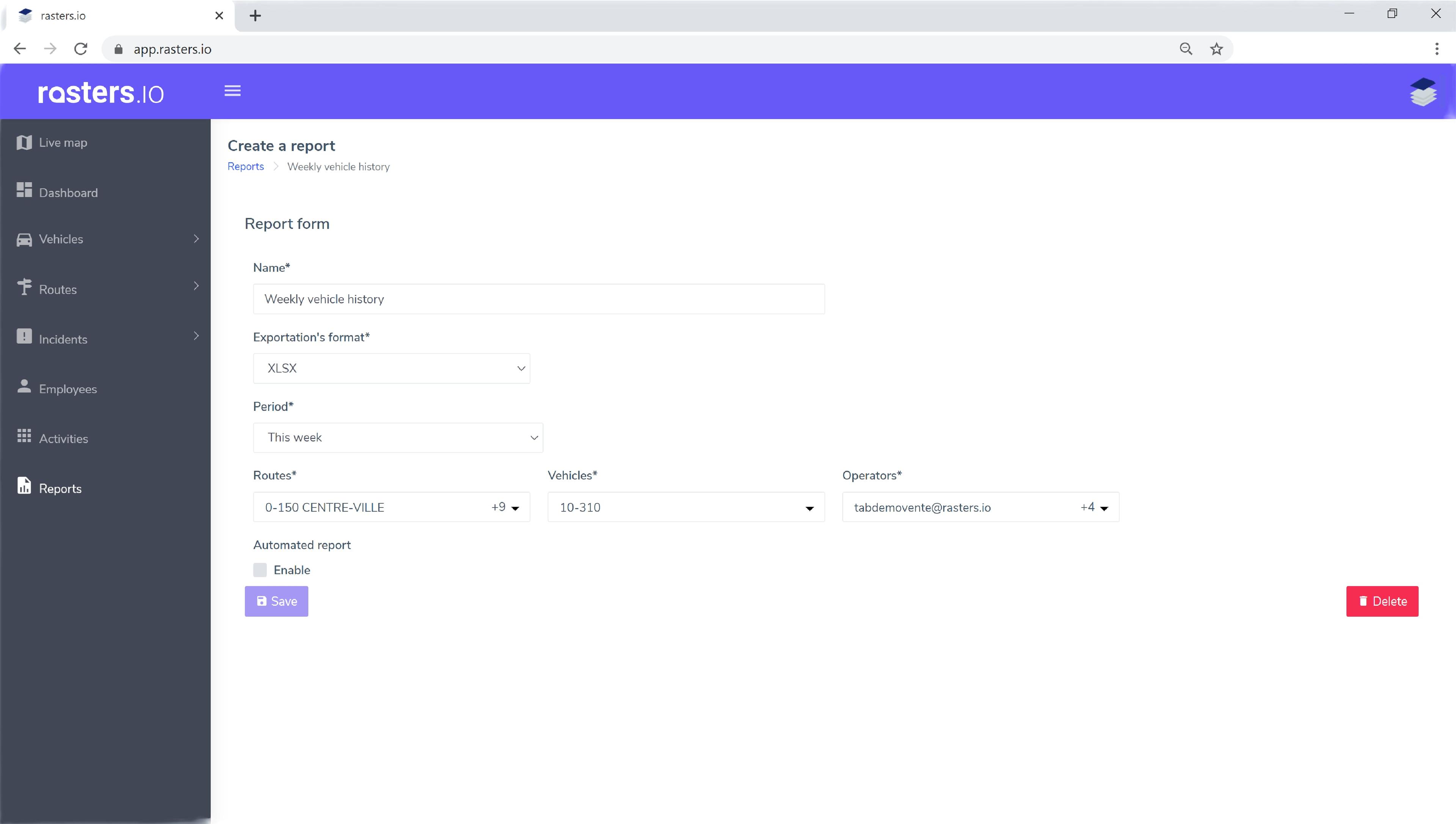
The reports
Generate different types of preconfigured reports with the platform's reporting module.
The module allows, depending on the reports, to dynamically specify parameters such as dates, vehicles considered for the generation of the report, operators, etc.
All reports can be generated in Excel or PDF.
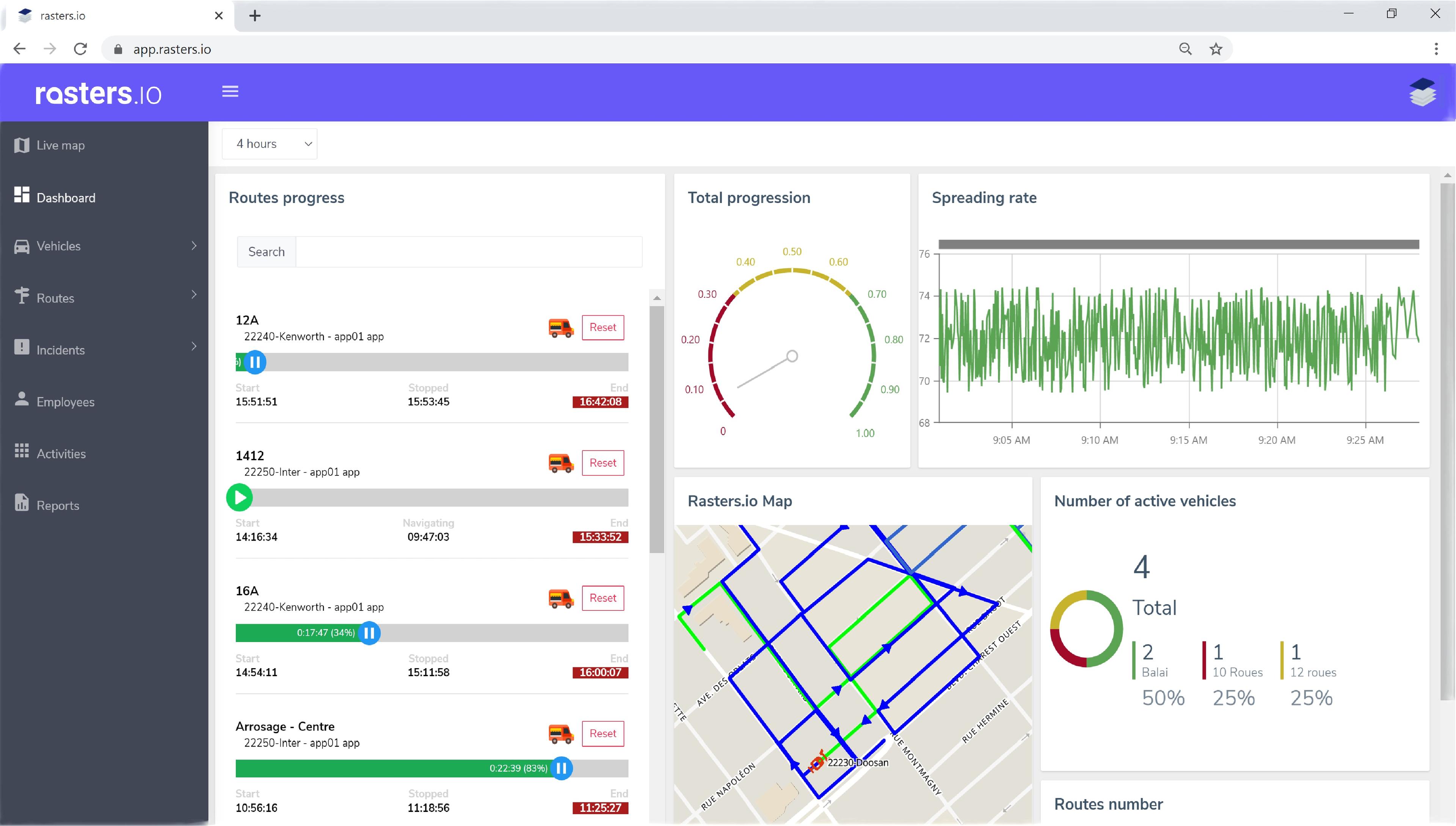
The dashboard
Consolidate the data collected and get a real-time overview of the most important indicators of your operations with the dashboard.
- Individual progress of routes
- total progress
- operating vehicles
- spreading rate etc.
Given the flood of information you receive every day, having realtime access to the most critical information is essential to enable more effective decision-making in emergency situations.
Collect various information about your vehicles, equipment and sensors with Rasters.io.
The alerts and notifications module allows you to analyze all this information in real time in order to warn you of problematic situations.
Whether it is to monitor the status of equipment, the fuel consumption of vehicles or the idle time in a specific area, Rasters.io will keep you informed and always in control 24/7.
Generate different types of preconfigured reports with the platform's reporting module.
The module allows, depending on the reports, to dynamically specify parameters such as dates, vehicles considered for the generation of the report, operators, etc.
All reports can be generated in Excel or PDF.
Consolidate the data collected and get a real-time overview of the most important indicators of your operations with the dashboard.
- Individual progress of routes
- total progress
- operating vehicles
- spreading rate etc.
Given the flood of information you receive every day, having realtime access to the most critical information is essential to enable more effective decision-making in emergency situations.
Public Work Features
Specially designed for public works needs
Routes management
Routes management module
The route management module has been specially designed for public works needs.
Improve the planning, execution and monitoring of your public works operations.
With this module:
- Create predefined routes with a sequence of streets to be completed "turn by turn"
- Consult the history of the routes execution
- Display the status of operations in real time
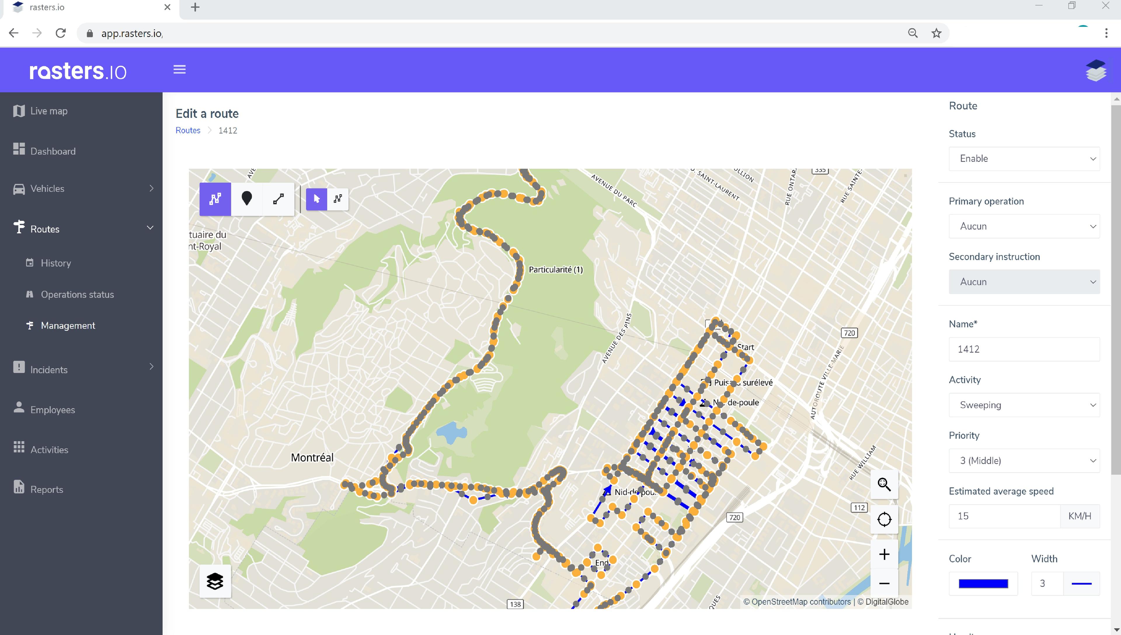
Routes management
Routes management module
With hundreds or thousands of streets to cover, several activities to manage that must be carried out on time and with the required service level, the work of the operators must be well planned.
Achieve this goal with the creation of predefined routes that allow managers to ensure the efficiency of operations and control costs (in terms of time and materials, fuel, spreading material, etc.).
The system allows you to define routes in three different ways:
- Create routes manually with the editing tool
- Generate a route using the vehicle history
- Import georeferenced files
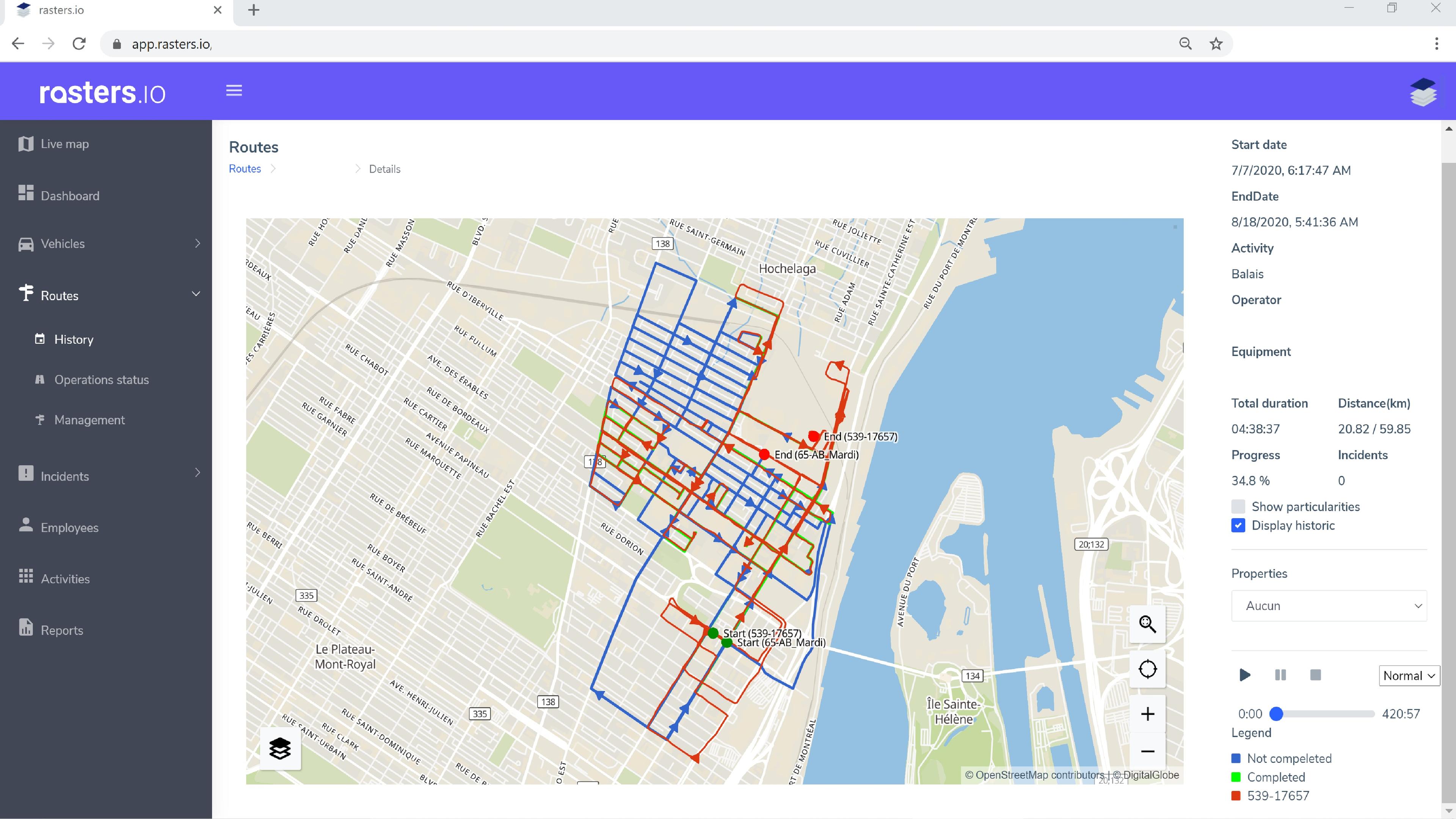
Routes management
Routes tracking
Improve the efficiency of your operations with the control and monitoring of routes execution.
In traditional fleet management systems, the control and monitoring is done with the trip history, but there is no link between the vehicle history and the planned work or what should be done.
Therefore, to ensure the application of routes and their optimizations, routes must be integrated into the platform. So you can overlay the real history of the vehicle on the routes and validate how it has been executed and if any streets have been forgotten.
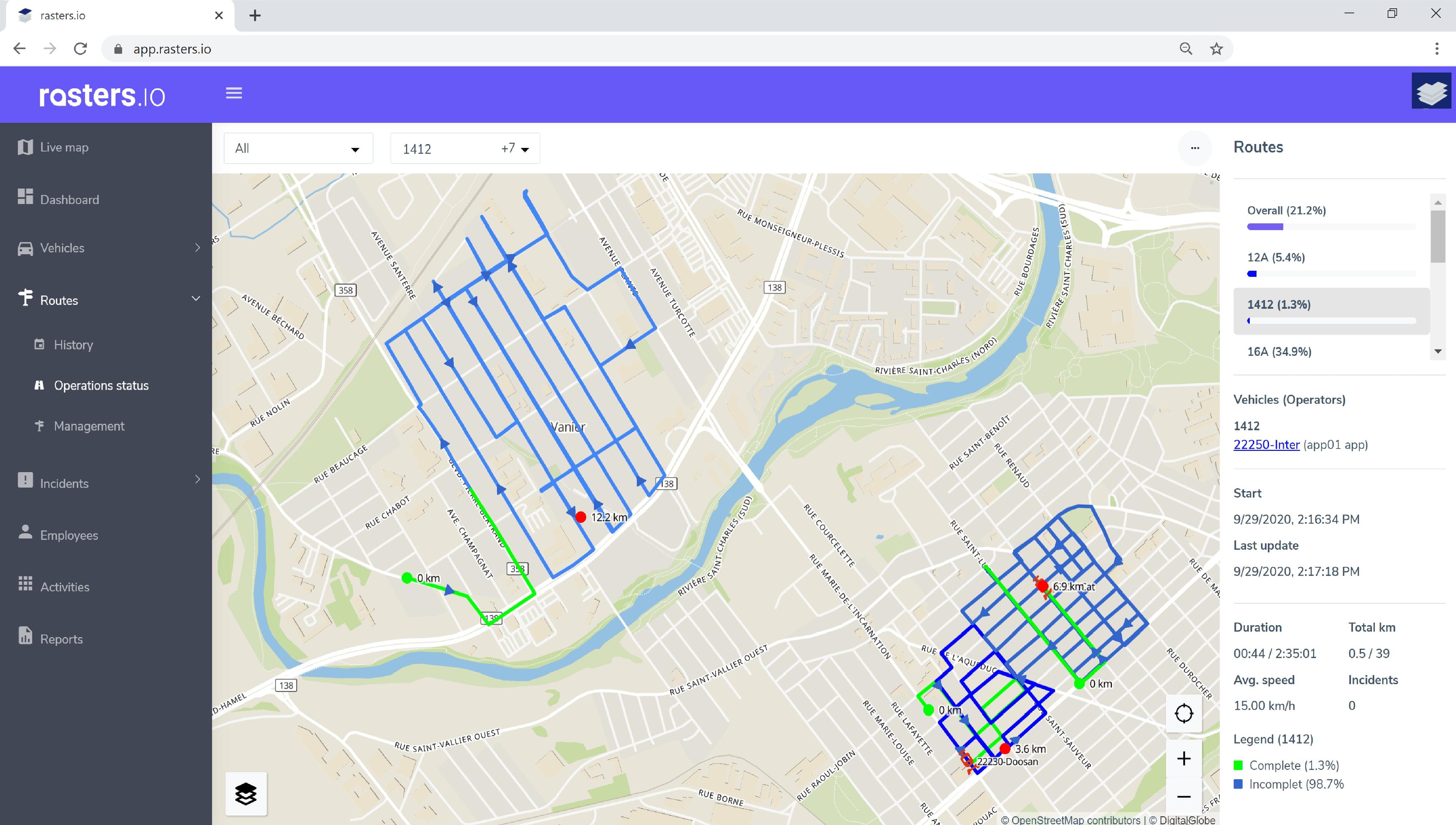
Routes management
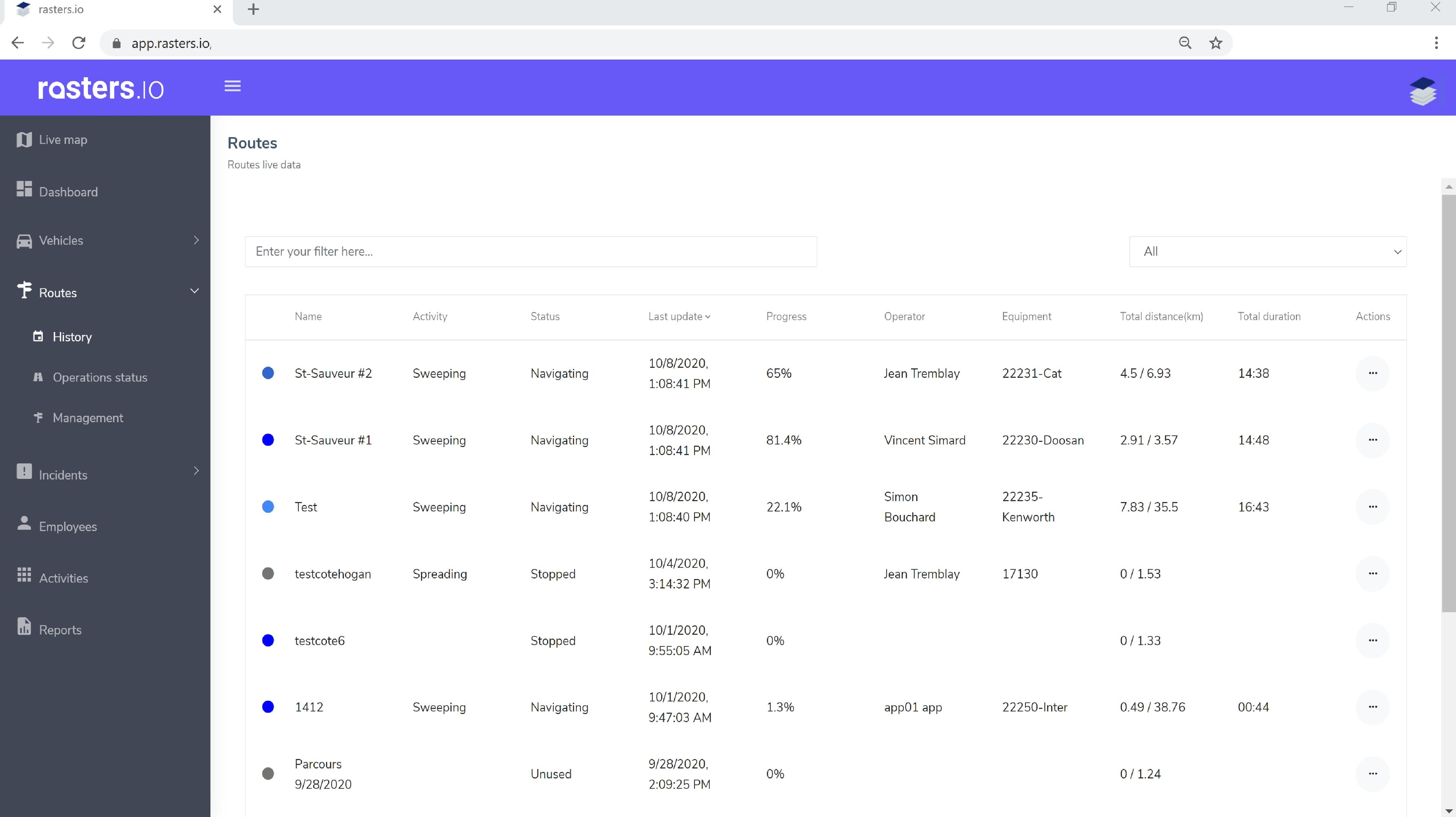
Operations status
Get with the operations status a complete real-time view of one or more activities with the overall progress of the routes as well as each of the routes individually.
Follow, in real time, the progress of your operations, check if streets have been forgotten and assign your staff according to the situation on the ground.
Check out the percentage progress of all your routes.
See the number of km traveled, operating time, number of vehicles, etc.
Routes management module
The route management module has been specially designed for public works needs.
Improve the planning, execution and monitoring of your public works operations.
With this module:
- Create predefined routes with a sequence of streets to be completed "turn by turn"
- Consult the history of the routes execution
- Display the status of operations in real time
Routes management module
With hundreds or thousands of streets to cover, several activities to manage that must be carried out on time and with the required service level, the work of the operators must be well planned.
Achieve this goal with the creation of predefined routes that allow managers to ensure the efficiency of operations and control costs (in terms of time and materials, fuel, spreading material, etc.).
The system allows you to define routes in three different ways:
- Create routes manually with the editing tool
- Generate a route using the vehicle history
- Import georeferenced files
Routes tracking
Improve the efficiency of your operations with the control and monitoring of routes execution.
In traditional fleet management systems, the control and monitoring is done with the trip history, but there is no link between the vehicle history and the planned work or what should be done.
Therefore, to ensure the application of routes and their optimizations, routes must be integrated into the platform. So you can overlay the real history of the vehicle on the routes and validate how it has been executed and if any streets have been forgotten.
Operations status
Get with the operations status a complete real-time view of one or more activities with the overall progress of the routes as well as each of the routes individually.
Follow, in real time, the progress of your operations, check if streets have been forgotten and assign your staff according to the situation on the ground.
Check out the percentage progress of all your routes.
See the number of km traveled, operating time, number of vehicles, etc.
Rasters.Navigation Features
Rasters.Navigation
Rasters.Navigation
Following a snowplowing route, with the constraint of turning right while having to look at a paper map, is quite a challenge for a new operator or a temporary worker.
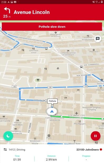
Your operators can now follow the predefined route instructions with sequence of streets to be completed "turn by turn" with a single Android mobile application specially designed for operators in the field;
Follow easily the route directions (text and voice) and watch your route change color as you progress.
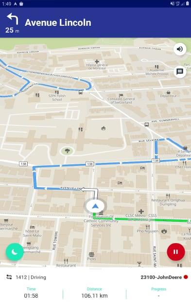
Rasters.Navigation
Rasters.Navigation
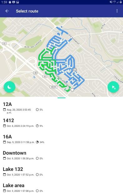
Automatically see the percentage progress of routes and be able to make decisions by choosing which route to take.
Choose your route according to the percentage progress and resume your journey exactly where the other operator left.
Leave your route, due to an obstruction, and come back further in your route, the instructions will start again at the specific point where you come back in your route.
Report information in the central platform in order to warn of an anomaly, an obstacle or an incident during the execution of your route.
Rasters.Navigation
Diffusion of routes particularities
Provide the operator with specific route particularities, which are points of interest positioned on a route, and mainly used to share information.
Inform the operator on approach if there are any particularities nearby throughout his route progress.
When the operator follows his route, the application indicates the specific instructions to be taken into consideration such as "beware of the pothole",; "lift the truck plow, raised sump", etc.
Rasters.Navigation
Following a snowplowing route, with the constraint of turning right while having to look at a paper map, is quite a challenge for a new operator or a temporary worker.
Your operators can now follow the predefined route instructions with sequence of streets to be completed "turn by turn" with a single Android mobile application specially designed for operators in the field;
Follow easily the route directions (text and voice) and watch your route change color as you progress.
Rasters.Navigation
Automatically see the percentage progress of routes and be able to make decisions by choosing which route to take.
Choose your route according to the percentage progress and resume your journey exactly where the other operator left.
Leave your route, due to an obstruction, and come back further in your route, the instructions will start again at the specific point where you come back in your route.
Report information in the central platform in order to warn of an anomaly, an obstacle or an incident during the execution of your route.
Diffusion of routes particularities
Provide the operator with specific route particularities, which are points of interest positioned on a route, and mainly used to share information.
Inform the operator on approach if there are any particularities nearby throughout his route progress.
When the operator follows his route, the application indicates the specific instructions to be taken into consideration such as "beware of the pothole",; "lift the truck plow, raised sump", etc.